A vacation!

I took a few days off work and Sean and I went to a cabin in Ellijay, the north Georgia town that hosts the apple festival I go to every year. Not sure if I’ll make it this year, given, you know, coronavirus, so it’s nice to be up here now. The cabin is lovely, just the right size for two, well appointed and cozy. We honestly haven’t done much besides lounge around. Each day has had one “event”: the first day we got hibachi takeout for dinner, the second day we picked up groceries, the third day we took a bath in the big tub, and today I went on a walk around the (very hilly) neighborhood. We leave tomorrow; I wish I’d made this a longer vacation, because I’m finally starting to feel like doing things. I had thought I would at least do some writing, and possibly some photo editing. Oh well! Ultimately the point was to get a break from everything, and I think we’ve accomplished that, at least.

There are more photos at my SmugMug.

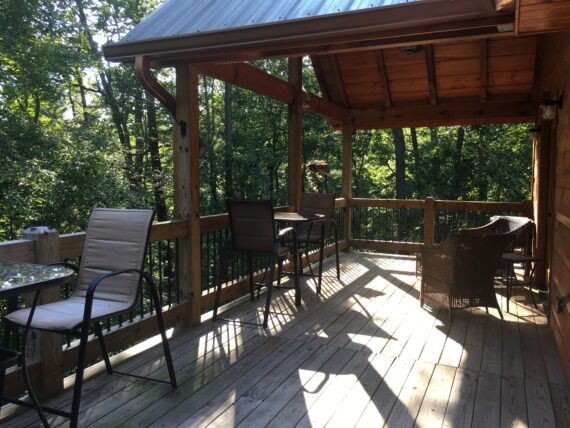
The back deck of our rental cabin in Ellijay, from which you can hear the soothing sound of the rushing river hidden beyond the trees

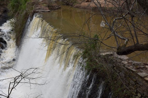
Tallulah Gorge

Spring is arriving in Atlanta in fits and starts. One day it’s sunny and 72, the next it’s dreary and in the 30s. We’ve had some amazing blooms this year, starting with some early redbuds in February and continuing through cherry blossoms and dogwoods and more redbuds and whatever those extremely tall trees with the sprays of white are. Gibbs Gardens has looked incredible each of the times I’ve gone. So far this year I’ve visited on four different Sundays: March 4, the first weekend they were open for the season, at which point cherry blossoms and daffodils were the main features; March 25, when the trees were mostly still bare, the cherry blossoms were gone, but the daffodils had been joined by colorful tulips and an array of pink-flowering trees, including redbuds; April 1, at which point the gardens were bursting with brightly colored petunias, white balls of viburnum, and pink azaleas; and April 22, when the Japanese maples framed the pools and walkways in sprays of brilliant red.

That last weekend, I’d considered going somewhere else. On Saturday the 21st I woke up thinking that I should go hiking. I liked the idea of going to Gibbs again, but I’d been three times already, and it would be nice to go somewhere new. Plus, there are many places in Georgia I’ve been meaning to see. I started poking around online and decided that Tallulah Gorge would be the perfect place–but I had already spent most of the day at home, and it’s an hour and a half drive to get up there, so I decided to hold off. The next day, it was supposed to rain, so I didn’t want to go that far only to not be able to spend much time. I decided last-minute to go to Gibbs again, banking on the rain not starting until around noon, and it worked out perfectly; the rain came as I was driving home.

The idea of going to Tallulah Gorge stuck with me, though, and when I saw that this weekend’s weather was forecast to be incredible, sunny and 72, I decided that Saturday, yesterday, would be the day.

The drive up was extremely easy. I didn’t need to leave Google Maps running; I simply read the directions and went: I-285 to I-85 to I-985, which turns into US-23. The turn for Tallulah Gorge’s Jane Hurt Yarn Interpretive Center is right off that highway.

My first stop was Tallulah Point Overlook, which I’d read about online. It’s a gift and supply store with an ice cream and candy shop upstairs and a burger and fried peanuts stand off to the side. From the store’s back porch and the upstairs porch beyond the ice cream shop, you can look right into the gorge. There was a lot of foliage, so the view wasn’t amazing, but I did see some charging rapids between the trees. I was really glad I’d come, because I loved the store; it’s filled with homey trinkets and nice souvenirs and feels very charming and welcoming. I got a Tallulah Gorge t-shirt and a handmade pottery Tallulah Falls magnet. If it hadn’t been too early to eat, I would have had some ice cream.

After that I drove to the Interpretive Center. It was around 11 am at this point and the parking lot was packed. I ended up parking in the grass, next to several other cars doing the same. I wanted to get right to hiking, so I skipped the Interpretive Center and headed down past a sign that said “North Rim Trail.” I had a vague idea of what the trails were and which ones I wanted to go on–the rim trails go around the rim of the gorge and offer spectacular views, so definitely those. I was surprised to find the trail blazed with recycled tires, like some of the trails at Amicalola Falls. The overlooks were jam-packed with people. It felt more touristy than I had been expecting, though I’m not sure why it didn’t occur to me that a popular destination would have friendlier trails.

As soon as I hit the stairs for the Hurricane Falls Trail, I abandoned the North Rim Trail and headed down. I knew there was a suspension bridge and I definitely wanted to cross it. There are 310 steps down to the suspension bridge; I got through these fine and stepped out onto the bridge.

I was sort of expecting the bridge to be scary, or the views to be better, but the slight wobbling wasn’t frightening at all, and the views were obstructed by all the suspension lines. Being on the bridge didn’t give me as much of a thrill as I had hoped, but it was still neat.

After the bridge, there are 221 steps down to the gorge floor. We were allowed to walk down to a pier-like structure there that led out to a nice view of Hurricane Falls. Access to the actual gorge floor was cut off, as this weekend they are doing an “aesthetic flow” and allowing more water through the dam, so that Tallulah River is too high for people to walk near. Of course, this flow means all the waterfalls looked really cool, and Hurricane Falls was no exception.

Back up the 221 steps, I was starting to flag. My legs were shaking and I was starting to get short of breath. I had to stop several times to rest; thankfully there are platforms for this purpose, so I was able to get out of the way.

At that point I could have gone back across the suspension bridge and up the 310 stairs, but I chose to do the 347 steps up to the South Rim Trail, which runs along the opposite side of the gorge from the Interpretive Center. I did not notice at the time that there were more steps up than I had come down, but a guy going the other way mentioned it to me when I got to the top. Of course, this was after a lot of struggling and stopping and drinking water. I’m really happy to have conquered all those stairs: 1099, all told.

The overlooks from the South Rim Trail were great. At one point there were stone stairs leading up to some huge rocks that you could stand on. I climbed up there and someone kindly took my picture standing on one of the rocks, with the gorge in the background. (I took theirs in return.) Then I sat down on one of the other rocks and had lunch. It was great.

After that, it was just a matter of finding my way back to the other side of the gorge. I did not particularly want to try to do the stairs again. I thought I’d read online that it was possible to cross where the highway crosses, so I headed in that direction. Sure enough, it worked out. The signs got confusing, but I finally figured out that I needed to cross the road on the sidewalk and then take a flight of stairs down to the trail.

From on top of the bridge, I got a great shot of the gorge, and some photos of what may have been a peregrine falcon–I’m not sure, but it was big, and there is a family of them nesting in the cliffside, so here’s hoping.

Once back on the trail, I had some pretty cool views of the waterfall pouring out of the dam I had just crossed. Then it wasn’t long before I was back to the Interpretive Center and my car.

All in all, it was a very satisfying hike! I had a really great time. My legs are so sore today, but in that good way that gives you a sense of accomplishment. I’d love to go back in early spring or late fall, when the trees aren’t so leafy, to get less obstructed views of the gorge.

A life update

I stopped blogging for awhile there, huh?

Let me try to let you know what’s happened since I stopped doing the daily recovery posts back in December.

I guess the most important thing is that my heart recovered.

results showing a normal ejection fraction of 55-60%
My echocardiogram results, February 1, 2017

This news came on February 1 with an echocardiogram. I was astonished; I thought my heart might have improved a little, but the result was an ejection fraction of 55-60% (normal). Heart Failure Part Deux was far shorter than the first time around! I credit it to three things: 1) the heart medication, obviously; 2) I changed my diet and started exercising right away; and 3) I started out 120 pounds lighter than I was the last time. I am pretty confident that #3 played a major role, and I am so thankful to have had weight loss surgery.

Other than that, I have been playing Medication Roulette and going to therapy to deal with various things. Sometimes it seemed to be going well and then something would go wrong. Things seem to be looking more promising now. We’ll see, I guess. The latest issue is that a medication I was taking was causing me to be tired all the time. No amount of sleep was ever enough; I was always drowsy and had no energy to do anything. So I switched off it back to a lower dose of one I had been taking before. We had switched off that one because I had an anxiety attack and things got really, really bad, but I think the problem was that the dose had been increased. So back to the original dose. Fingers crossed. (I can’t take extended release medications, and this seems to rule out a lot of options.)

Unfortunately, coming off the medicine that made me drowsy has been very difficult. At first we tried cold turkey, but doing that made me too sick to function. Next we tried to wean me off it, which went better at first, but now, at the end of the weaning period I seem to not have weaned slowly enough. More on this below, but first some fun things.

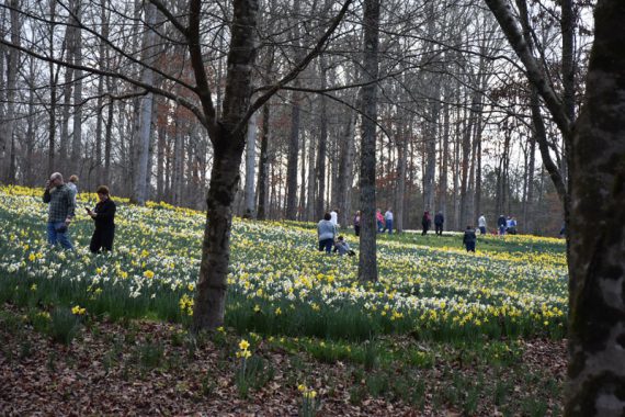
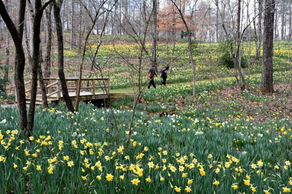
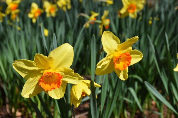
The winter was pretty mild, with occasional arctic blasts, resulting in Gibbs Gardens’ daffodils blooming early. They moved their opening from March 1 to February 18; I went on Sunday, February 19, because Saturday was rainy. It was a beautiful day and the daffodils were everywhere.

wide shot of daffodils all over a hill
Daffodils at Gibbs Gardens, February 19, 2017

daffodils in the foreground extending all the way back to the horizon up a hill
Daffodils at Gibbs Gardens, February 19, 2017

closeup of two daffodils with other daffodils behind them
Daffodils at Gibbs Gardens, February 19, 2017

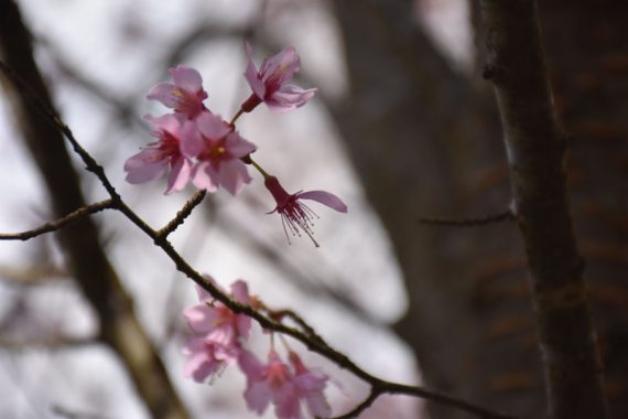
There were also cherry blossoms!

detail shot of cherry blossoms
Cherry blossoms at Gibbs Gardens, February 19, 2017

It got kind of cold again for awhile, but then on March 11 I went hiking at Vickery Creek in Roswell. It was a fantastic hike and I want to go back soon…especially since I didn’t get to see the mill ruins. (I did see the manmade waterfalls though!)

a broad manmade spillway
Roswell Mill waterfall, Vickery Creek, March 11, 2017

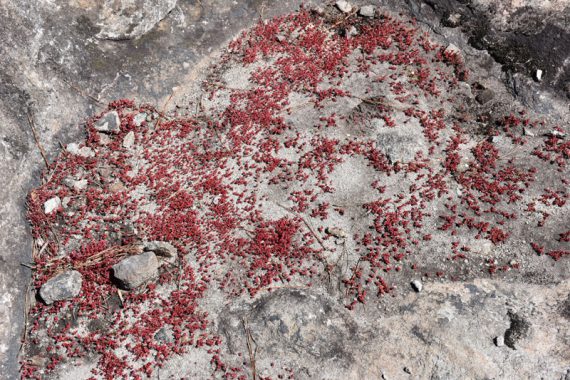
On March 19 I went to Arabia Mountain with Charles and Heidi. We took their dog Ginny with us :) I had been to the area before on my own, but I was on the wrong side of the street and never climbed the actual mountain. We did the Mountain Top Trail. Arabia Mountain is like Stone Mountain, except it’s smaller and it has these amazing little pools of plant life in its “craters”. One of the plants is this strange, almost coral-looking red stuff called diamorpha. It was everywhere and I got lots of pictures.

a wide shot of odd red plants inside a rocky crater
Diamorpha at Arabia Mountain, March 19, 2017

I was unable to hike, or really go anywhere, this past weekend due to withdrawal symptoms from the medication I switched off of. I actually had to leave work early because of it. I would get extraordinarily dizzy, and when I’d move my eyes I’d hear strange echoes in my head. It was very unpleasant. The symptoms lasted until Monday morning, when I gave in and took half a pill. Since then I’ve been all right, but I’m prepared to take another one tomorrow if necessary, because that dizziness is no joke.

I want to try to hike/visit a garden every weekend now that the weather’s nice, because being outside makes me feel so great. I’m considering Piedmont Park and the Botanical Garden for this weekend but I heard on the radio that Zoo Atlanta has a new Treetop Trail and it sounds really fun. There’s also Kennesaw Mountain, which I’ve been to before but never in spring, and Smith-Gilbert Gardens, and Sweetwater Creek, and Stone Mountain, as well as plenty of places I haven’t been yet.

Just thinking about being outside has made me feel a lot better than I did when I started writing this post :)

Well, I’m sure I could ramble on about more stuff, but it’s past my bedtime, so I’ll sign off here.

Adventure at Sweetwater Creek State Park

Today I spent five hours exploring Sweetwater Creek State Park, a conservation area to the west of Atlanta. I walked, I hiked, and at times I even climbed, wandering around four marked trails and covering nearly nine miles. I saw beautiful forest, plenty of squirrels and bugs, a couple of deer, two tiny frogs, a long expanse of creek churning through white and gray stone, and the beautiful brick ruins of a mill.

Ruin of new Manchester Manufacturing Company millI got out of bed this morning determined to do something with my day off other than clean, cook, sit at my computer, and watch TV. I’ve gotten into a decent rhythm of late with chores and meals, and this has helped us to save money by not going out to eat, but I’ve been going stir crazy in the apartment. I needed to get out and do something fun and productive and healthy. So I decided to find a park to explore.

Atlanta has no shortage of parks, as I discovered when I started googling. This list is huge, and it isn’t even conclusive. I scanned down the page for anything with a good deal of acreage, then started checking for websites or community information. A number of interesting sites cropped up, including Grant Park, Freedom Park, and Chastain Park. (I’ve been to Piedmont Park before and wanted to find something new.) At some point my searching led me to the PATH website. The PATH Foundation builds walking and cycling trails across Atlanta. I was intrigued by several of the projects, including the Silver Comet Trail. I realized I had already seen part of the South Peachtree Creek Trail when Charles and Heidi took me to Mason Mill Park years back.

Ultimately, though, I decided I wanted to rough it a little more, and Sweetwater Creek, a conservation area, started to stand out. I noticed that it’s relatively close to where we live, and from the description it sounded like it would be really fun to explore:

Sweetwater Creek State Park is a peaceful tract of wilderness only minutes from downtown Atlanta. A wooded trail follows the stream to the ruins of the New Manchester Manufacturing Company, a textile mill burned during the Civil War. Beyond the mill, the trail climbs rocky bluffs to provide views of the beautiful rapids below. Additional trails wind through fields and forest, showcasing ferns, magnolias, wild azaleas and hardwoods.

My destination decided, I set about preparing. Obviously my Nikon was going. I shifted my wallet and little Canon into the bag. I’d also need provisions. I packed a bag of almonds, an Atkins bar, and some snack crackers, then made some tuna fish salad to carry in a cooler with an extra bottle of water. I also fried some bacon, and despite the fact that I left it too long and it got crunchy, I bagged it up as well.

Then I realized that I should probably charge my Nikon’s battery.

As I sat watching the blinking light on the charger, waiting for it to stop its strobing, I realized I would go nuts if I sat around waiting any longer. It was past noon, which meant the Marietta Square Farmers Market was open; I went to an ATM to pull a $20 and then headed up there to buy peaches, tomatoes, and potatoes. (I also bought a small lemon-chess pie for $3 from a vendor whose sweet potato pie is apparently beloved by President Bill Clinton.)

This little excursion gave the battery plenty of time to charge. However, by the time I got home, I was hungry, and Sean needed lunch too. So I boiled some hot dogs and made macaroni and cheese and sat down and ate. Time ticked by as I waited for the food to settle.

And then, finally, I was ready.

Everything was all packed, so I snagged the cold items from the fridge and put them in a cooler with some ice, grabbed the camera bag and my Camelbak water bottle with purse strap addition, and I was on my way.

The drive wasn’t bad and the website’s directions were pretty clear, so I found the park without incident. Upon arriving I discovered there was a $5 parking fee; I hadn’t thought of this, so it was fortunate that I had change from the farmers market. “Enjoy the park!” the man at the booth said cheerfully, and I drove back on the winding road through the trees to the parking lot at the very end, near the Visitors Center.

I’d read up on the trails online before heading out, and I intended to simply take the red trail; it was short and sweet and led to the main attraction, the mill. However, there were people everywhere. A group of kids, one a teen, one possibly a tween, and one who looked maybe 7 were goofing around and talking loudly. Huge families and throngs of friends loped by with baby carriers and walking sticks. I felt that to avoid them–to keep them out of my personal space and my photos–I would have to keep hurrying up and then stopping and waiting, and that didn’t seem enjoyable. So when an unmarked side trail branched away from the red trail, running down along the creek, I took it, and was instantly comforted by solitude.

Side trail along Sweetwater CreekEventually the side trail I was on led me to a bridge that spanned the creek; I saw that the yellow trail also led here. I remembered vaguely from my reading that this trail was longer than the red trail. More importantly to me, it was deserted. Everyone seemed to be fixated on the red trail. Without a second thought I crossed the bridge.

Yellow trail bridge across Sweetwater CreekI got turned around at first, heading down what I thought was a trail but what was actually apparently a service road. RunKeeper’s GPS helped me see that I was going nowhere; I turned back and found the yellow markers leading off away from the bridge, along the creek the way I’d come on the other side. I followed them, and eventually a left fork in the trail guided me away from the creek and into the forest.

I hiked uphill. It was a long climb, but I felt good. It was only when I’d reached what seemed to be the highest point of the trail (though it was hard to tell with all the trees) that I saw any other people. Two men walked by together, and then a third came up behind them moments later. I greeted them all cheerfully.

Yellow trail, Sweetwater Creek State ParkAs I wound my way back down and around, I remembered that the yellow trail was a loop, and the fork in the trail must have defined its start. Sure enough, I found myself walking back along the banks of the creek, and eventually I passed the point where I had set off into the woods. I retraced my steps to the bridge, crossed back over, and this time followed the yellow trail back to the parking area.

I could have called it quits then and headed to the car. It had been a good hike, with lots of uphill climbs. But I had plenty of water left, and I wanted to see the mill. So I turned back to the red trail, which by this time was thankfully less populated. One of the first things I saw was a beautiful butterfly atop a mound of dog doo. Of course I got a picture.

A gorgeous butterfly atop a turd.I found the beginning of the red trail to be far less strenuous than the yellow trail had been. It was mostly flat and very wide. Occasionally there would be an area off to the left where I could climb down to the rocky shore. The red trail also offered some lovely views of Sweetwater Creek.

View from the boardwalk alongside the ruined millIt wasn’t long before I reached the ruined mill. I was overjoyed to discover plenty of great angles for photography, from the trail and from down along the creek. The mill is inaccessible thanks to chain link fencing, but the views are still spectacular. The crumbled brick and empty windows reminded me of the old Sheldon Church ruins near Beaufort, the ruined abbey in Whitby, and Roche Abbey. And the wooden steps down to the mill reminded me of the forest jaunts my classmates and I took during our 2001 trip to Japan. Meanwhile, the water lapping and sometimes surging through the smooth rocks of the creek took me back to my childhood exploring of creeks and rivers in Kentucky. I was enchanted.

Mill stairs creek and rocks
Ruin of new Manchester Manufacturing Company mill Ruin of new Manchester Manufacturing Company mill

Once I’d had my fill of the mill, I decided to keep going on the red trail; a sign indicated that “Sweetwater Falls Overlook” lay ahead just half a mile. I didn’t remember from my morning reading that this part of the red trail was difficult, and so I was surprised when soon I was having to climb over rocks and fallen trees and watch my footing across narrow passages. It took much longer to navigate this part of the trail.

Small, rusty slide, red trailEventually I came across a large family I’d seen earlier; they were out on the rocks looking at and playing in the water. “She caught up with us!” yelled the father, as though this was a horrible thing to have happen. “Everybody back on the trail!”

“What, are we racing?” I mumbled to myself, annoyed, and continued on. I found a set of metal stairs, easily traversed, and shortly thereafter a long passage of railroad ties that might have been meant as stairs but which were far too steep to walk up. I used my hands and climbed, eventually finding myself on a boardwalk. I could still hear the loud family below me, but they seemed to be growing distant. I wondered if they would attempt the climb; it seemed a bit much for the littler ones.

Looking down from the boardwalk, I saw the creek cascading a few feet down some rocks, and I took a picture.

Sweetwater Falls?It never crossed my mind that this could be “Sweetwater Falls”. When I hear “falls”, I expect a waterfall–something tall. So I kept walking, wondering when exactly I would find the falls.

I knew that the red trail had ended and that I was now on the white trail; when I’d climbed up the hillside, I’d been met by a sign indicating that the blue trail was to the right and the white trail was to the left. I’d gone left, thinking the right would just go back to the parking lot (which, as I discovered much later, was correct). I didn’t remember that the falls were supposed to be at the end of the red trail. So I kept walking and walking and walking. And of course, I never found any “falls”, though I did enjoy the views of the creek to my left and the rocky cliff face to my right.rocky cliff faceflowersEventually the trail headed away from the creek and into the woods, and I knew I’d missed the falls somehow. “If I hadn’t seen the mill, I’d be pretty disappointed right now!” I said aloud. I decided to see where the trail went rather than turning around. I didn’t remember anything about the white trail; I was assuming it was one-way and that I would eventually have to go back, and I decided that when I did, I would take the blue trail to avoid having to climb down the side of the hill.

But the white trail kept going, eventually coming to a bridge and some very helpful signage. The bridge, apparently, led to a residential area; I was at the very edge of the park. The white trail continued in a loop that would eventually end back up near where I parked. It was quite a distance, but so was the way I’d come…not to mention that the way I’d come was rough, while the white trail seemed smoother. I continued forward.

White trailAfter a time, the white trail stopped being as obvious. Occasionally the forest cover would break and I’d emerge into a meadow; sometimes white strips were affixed to various plants along the way, and sometimes there was no sign of which way to go. I find it easy to follow established forest trails, whether marked or not, but I wanted to make sure I was headed in the right direction. Sometimes different trails would intersect with the one I was walking, and I was never quite sure if I should take them. I consulted RunKeeper’s continually-updating map to help me decide; somehow the GPS kept working even when I was out of my service area.

Moon visible from clearingFor the most part I made the correct decisions, but at one point I was flustered by the fact that the sun was going down and I needed to get north as soon as possible, so I followed an unmarked trail that seemed to be going in the right direction. At first everything seemed fine; it was a wide, clear path. My first indication that something was amiss was when I came upon a house. I was still within the boundary of the park, so I assume it was the home of a caretaker; there were two trucks in the yard, and one of them was marked “Georgia Department of Natural Resources”. I probably should have just turned around then, headed back to where the trail split and taken a different branch…but instead I kept going.

The path turned into what was obviously a service road, and that turned into a wild mess of rutted dirt and fallen trees. As I tramped through, a deer looked up, startled, and before I could raise my camera, it bounded away. Another one disappeared into a stand of trees just beyond it. I was a little unsettled, but continued walking; GPS informed me that I was at least heading in the right direction, so I hoped I would come upon one of the marked trails shortly.

deer footprintAfter awhile, the service road seemed to die out, and I was again walking a forest trail. This trail, though, was unmarked, and often unclear; it may not have been a human trail at all. I was having no trouble following it, though, and it was still going in the right direction, and the day was growing ever darker. I couldn’t see turning around at this point, not if I wanted to get to my car before the sun was completely gone.

For the last stretch of woods, there was hardly a trail at all. At one point, a thorny branch seemed to wrap around me, hooking itself to my clothes, and I had to wrestle myself free. The leaves crunching under my feet made me paranoid about snakes; I watched every step like a hawk.

And then, finally, blissfully, I spotted a clear trail running directly perpendicular to my current vector. I plunged out of the wilds and back into human space.

It was the blue trail. I turned left, and it guided me back towards the park entrance.

The trail was simple and mostly flat. I walked briskly, not daring to run in the dying light but knowing I needed to get out of the woods fast. At one point I stopped for a photo; the flash went off and two deer I hadn’t even noticed bounded away, perhaps the same pair I’d seen earlier.

As the trail wound around, I groused at it inwardly for not leading straight back to the parking lot. But finally the trees opened onto the back of a building I recognized as the Visitors Center, and the trail guided me up past it to a gently curving sidewalk. At the very end of that sidewalk was the parking lot, and directly across from it sat my car…the only vehicle left in the lot.

my lone carI had made it!

I slid into my Yaris and turned up the A/C. Taking deep drags from the spare water I’d left in the cooler, I drove my winding way out of the park and back to I-20.

In all, the hike lasted five hours. Here’s the RunKeeper map. Towards the end I could tell my legs were tired, but at the same time I felt like if I’d only had more water and sunlight, I could have kept going forever. When I got home and started cleaning up, I discovered thick rings of dirt around both ankles, evidence of my day of hard fun. I also discovered I’d taken a whopping 408 photos, which I later culled down to 377. Click here see them all.

This amazing adventure was just what I needed. It left me so energized and happy. I’ll definitely have to remember to go hiking the next time despondency tries to set in!

me

A new adventure

As you may have gathered from my previous post, Sean and I have made the move to Marietta, Georgia, a suburb of Atlanta in Cobb County. Sean found a job here last fall; I’m telecommuting to my job back in Augusta for the time being.

We’ve mostly settled in to our new apartment–the furniture’s arranged, the kitchen’s functional, and we just have a few boxes left to unpack. The last few weeks have been a whirlwind, dealing with moving and adjusting to our new place. I think we’re finally getting comfortable and falling into a good routine.

One of the nice things about working remotely is that my commute time is zero. Another nice thing is that I’m able to do things around the house on my lunchbreak. What makes it especially nice in our particular location is that I chose an apartment complex nestled in the woods, a cluster of cozy buildings scattered across hillsides carved out by streams leading down to a river, walking distance from a nature preserve.

I’ve walked down to the river and through forest trails twice now, once alone and once with our friends Charles and Heidi. Yesterday, I decided to explore the apartment grounds themselves.

The complex boasts the standard luxury apartment amenities, including a gorgeous clubhouse. It’s on the far side of the property from our apartment, and uphill to boot, so I got a good workout strolling over there on my break.I took my time, stopping for pictures everywhere, and I wandered off on side trips, enjoying the lovely landscaping and exploring what amenities the grounds have to offer. It almost felt like being up in the mountains, but warmer and busier what with the traffic from residents and the relative closeness of the buildings.

When I got to the clubhouse, I found most of the rooms manually locked–my key card worked, but the doors still wouldn’t open. The fitness center was available, and that was about it. I went up to the lounge and tried my key and was met with the same frustration.

“Do you have a key card?” asked a voice behind me. I turned; it was a cleaning lady.

“I tried it already,” I said, but dutifully pulled it out and tried again.

The lady tried the door too, using her own card. “It’s locked from the inside,” she said. “I don’t know why someone would do that.”

We walked to a different door, and she managed somehow to get that one open. “There you go.”

“Thanks!” I said, and went in.

The room’s very nice. Cozy isn’t the word, since it’s so big, but it’s comfortable. My attention was immediately drawn to the pool table in the back, and after a bit of looking around, I played a very weak, but fun, game of 8-ball with myself.

As I was racking the balls for a second game, the girl I’d passed at the desk on my way in opened the door.

“Can I help you?” she asked.

“I was just playing some pool,” I said.

“This room actually isn’t open right now.”

“…oh,” I said. “Well, I’ll just rack them back and be on my way!”

I wasn’t particularly embarrassed, which is impressive for me. I tidied up the pool table and hung the rounded triangle back on the accessories rack, then followed the girl back out of the room and downstairs. She let me know the hours the room is actually open (too few, really), and I thanked her and went on my way.

As I was strolling back towards my apartment, taking in the warm sun and tall trees, a silver car pulled up and honked lightly. I glanced over as the window rolled down.

“I’m so sorry!” the cleaning lady said. “I didn’t know it wasn’t open! I’m just the cleaning lady.”

“It’s okay,” I told her cheerfully. “At least I got one game in.”

She laughed, and I smiled and waved, and we both continued on our separate ways.

Adventure at Aqueduct Park

I didn’t set out to endanger my own life today, but that’s what ended up happening.

Some time back, Augusta cleaned up the aqueduct between the Augusta Canal and Lake Olmstead and dubbed the area Aqueduct Park. Whitewater rapids spill down a long stretch from the canal into a swimming area that’s also fed by a trickling waterfall on the other side. That pool drains off towards Lake Olmstead, a body of water the size of a pond that sits near the Augusta GreenJackets’ minor league baseball stadium. To get to the park, you either have to travel the Augusta Canal trail by foot or bike, or drive in along a gravel and dirt road from Sibley Mill.

Rushing flume of water at Aqueduct Park

I’d ridden past the area many times on my bike, and even taken a few pictures of the waterfalls and swimmers from up top, but I’d never climbed down to the pool. After the park was established, some trees were cleared, making the climb more inviting. This morning, desperately wanting to swim after my run and having few options–the Family Y doesn’t open until 1 o’clock–I clambered down rocks and dirt to get to the inviting waters below.

Aqueduct Park swimming hole

I’d cooled off considerably thanks to the air conditioning in my car, so to get back in the mood for swimming I hiked around the aqueduct area and took pictures. I tried to capture the beauty of the place–the rushing waters feeding in from the canal, the old brick tunnels now closed off at the end, the blocks and sheets of slate over which trickling waterfalls painted smooth, wet paths. By the time I was satisfied, I’d warmed back up and was quite ready for a good swim.

rushing waters brick tunnels rocks reflective pools reflective pool tiny waterfalls

Stripping down to my swimsuit and exchanging my tennis shoes for flip-flops, I carried my towel over to where the rocks gradually descended into the pool, laid the towel where I thought it would be most convenient, and then started to step down the rocks to the water.

This was my first mistake.

slippery rocks

The rocks were smooth, wet, and covered with slime. As I felt myself slipping, two thoughts occurred to me: one, that the water was very cold, and two, that flip-flops didn’t provide very much traction. I scooted down onto my bottom to try and slide into the water without falling.

It was then that I recognized my second mistake.

Filled with enthusiasm, and perhaps overconfident after successfully climbing all over rocks and waterfalls, I’d chosen to enter the water right next to the canal ingress. Right next to where the barreling flume of water was churning into the pool.

My ingress point

As I sat slipping on the rock, trying to pull off one of my flip-flops, the surging water caught me, thrusting me out and down into the pool. My flip-flop was instantly sucked away. As I struggled to keep my head above water, arms pumping downward to thrust my face out of the rapids, I thought, “If I drown here, like this, I am going to be pissed.”

My efforts were not in vain. I was never completely submerged. At first there was no ground beneath me, and I thrashed in terror to stay afloat, but then, suddenly, I found myself dashed upon the not-at-all smooth array of rocks that makes up the bed of the aqueduct pool.

“Ow,” I said. And then, “Well, I’m stupid.”

As the water continued to push me, gentler now that I was out of the direct path of the flume, I pulled off the other flip-flop for no logical reason, and, holding it, fought my way around the pond. The flume sent water churning in two directions: to the left, off towards Lake Olmstead, and to the right, forming a clockwise eddy circumscribed by the pool. I was caught going right, thankfully. The flume’s strength decreased little by little as I was pushed further and further away; I braced myself on rocks to keep myself steadily on my bottom.

The pool

Eventually the water no longer had the strength to push me, and I maneuvered myself to shore–to the spot where I should have entered the pool to begin with. There, the water merely lapped at the rocks and dirt as its final whirlwind strength was sapped away.

“I survived,” I said.

I took a barefoot walk back around the shore of the pool, hoping my flip-flop had washed up somewhere, but it was nowhere to be found. I resigned myself to throwing the other one away…but first I would wash the mud off my feet, clean out the shallow open scrape the rocks had left on my right knee, and get back into my sneakers. I was moving my shoes over to the rocks–the calm area–when I saw it. My flip-flop had somehow been deposited on the rocks right next to the flume. Perhaps during my flailing, I’d actually flung it backwards.

I laughed; somehow finding the other flip-flop was more of a relief than scrambling to shore. Maybe my brain took it as a metaphor of getting out of the situation in one piece.

the pool

I washed and dried my feet, tied on my sneakers, retrieved my wayward flip-flop, and began the hike back up and out of the aqueduct.

As I was leaving, a man walking his dog came down the pass. “Wow, I haven’t seen it rushing like this in a long time,” he said.

“Yeah,” I agreed. “It’s crazy!”

“It used to be like this all the time when I was a kid,” the man said.

“Really?”

“Oh, yeah.” He gestured back up to the top of the flume. “We used to slide down the rocks.”

Wow,” I said. If that was the case, then kids have been doing essentially what I did today for decades.

the flume

Maybe my life wasn’t really in danger. I hope that is of some comfort to my mother, who is probably horrified that this happened. Sorry, Mom.

I’ve learned some good lessons. Don’t walk down slippery rocks, especially in flip-flops. Don’t enter a pool fed by rushing water right next to that rushing water. And it probably wouldn’t hurt to get a good idea of the depth of a body of water before swimming in it.

All that said…I did have fun, and I’ll probably swim there again. :)

me in front of the little waterfalls

View the complete photo gallery here.

Update

Lots of stuff has been going on with me lately, and since I never seem to blog properly anymore, here are some links to pictures.

Photo: Living room TV area as seen from dining roomOn October 1, we rearranged the living room in order to better accommodate our new TV table. This is the happiest I’ve been with our living room…well, ever. There’s plenty of floor space for Wii Fit and Wii Sports, all seats provide an adequate view of the TV, and Sean has a nice big contained area for his clutter–comfortable for him, livable for me. This living room arrangement is composed entirely of win.

Photo: Sign for the Webmaster Jam SessionOn October 3 and 4, I attended the Webmaster Jam Session in Atlanta. I live-tweeted the whole thing, and also sent a few iPhone photo updates here. The photos I took with my regular camera are here.

It was a great conference. Having never been to a web conference before, I wasn’t quite sure what to expect, and certain things were different than I’d imagined. But I learned a lot and even met a few new people. Hopefully I’ll be able to go again next year.

Photo: Charles gazes fondly at a frozen cow's headOnce the Webmaster Jam Session was over, I headed over to see Charles and Heidi. Charles and I went to the Buford Highway Farmers Market, which is the greatest grocery store in the history of the universe. The next day, all three of us went to the Atlanta Greek Festival. We also spent some time just relaxing and chatting, which was nice. It was a short but really fun visit. I love seeing Charles and Heidi :)

Photo: The Atlanta Greek Festival gets its own gallery because it was so huge. I loved seeing the dancers, listening to the band, eating all the delicious Greek food, and exploring all the shops. I even bought a cookbook! The church where the festival was held was absolutely beautiful, so I took lots of photos. You can see them all here.

Photo: View of houses and the Savannah RiverSettling back into my normal routine after the whirlwind Atlanta trip was not an easy task. The following Monday I went to Riverwalk during my lunch break. It was an absolutely beautiful day, and there were lots of boaters out on the water. I jogged the walking path once, then sat by the river and took pictures. (I’m fairly pleased with how blue my eyes look in this one.)

Photo: Silhouetted leavesI went back to Riverwalk on Thursday, not to jog this time but simply to look around. We’d had a great deal of badly-needed rain Wednesday night, and Riverwalk was transformed. The Savannah was mud-colored and drab and the sky was overcast, but the plants felt vibrant and every surface was beaded with water. The very air felt fresh. It was a different kind of beautiful.

So there you have it. Lots of adventures, with hopefully more to come. :)

Published
Categorized as Uncategorized Tagged , ,

Brooke and Heather Day

I took Wednesday off from work so I could spend the day with Brooke. We went on a few adventures.

First, we headed out to Thurmond Dam, by way of Pollard’s Corner.

This is the way Brooke always used to go to the lake. Pollard’s Corner is also on the way to Lincolnton, where I worked briefly in the summer of 2005.

After our stop to pick up sodas and snacks, we headed on to the dam. We went through Georgia until we got to the dam, which is different from the way I went last time. Last time I took 28 through Columbia County and into McCormick County before I got to the lake and river. This time we drove right over the dam to get to the Visitors Center.

The center was open, so we went in and looked at all the displays explaining about J. Strom Thurmond Dam. My favorite part was the window-walled room with views of the lake and pictures and discussions of the wildlife. We had a lot of fun with the bird call recordings; click here.

We went outside and took some pictures of the lake and dam, but it was pretty cold so we soon hopped back in the car and headed on. At this point we hit the field with the old turbine display.

Then we headed towards the dam…but instead of going immediately to the main observation area, we drove down to the boat ramp. I hadn’t done that last time because I figured the road just ended at the water, but it turned out there was a broad parking lot there, and some great views of the river and dam.

Once we had our fill of this angle, we headed up to the observation area, where we snapped photos and sat in a porch swing for awhile.

Click here for a video.

On our way back from the dam, we stopped at the Bartram Trail golf community to see what we thought. The houses were mostly okay, but the yards were pretty small, and we didn’t think we would want to live there. I’d previously had high hopes for the area so I was fairly disappointed, but I’m not expecting to ever live in a house that large anyway. Brooke and David are looking for a larger-sized home so they can host family from England, so it was unfortunate that the yards didn’t meet Brooke’s expectations.

Following that we went on a more mundane (but no less fun!) adventure:

After Brooke beat the pants off me for three games, we decided to go to downtown Augusta for awhile, picking up David on the way.


I need to find a camera that won’t add random glowing pixels to night shots.

After that we stopped at the grocery store for supplies and then went to my apartment for dinner and Eton mess, which is ridiculously easy to make and amazingly delicious.

It was a long, fun day. I’m glad we were able to spend so much time together!

It’s a nice day.

Today I have eaten:

  1. 1 Slim-Fast (Strawberry)
  2. 1 tuna fish sandwich (homemade)
  3. 1 fat-free blackberry yogurt (Dannon)
  4. ~15 baby carrots

And while my readers are pondering whether or not they’ve accidentally opened an archived post from 2003…

I got a lot of sleep last night. I left work early and went to bed right when I got home. I woke up at around 11, and got up for a couple of hours, but then I went right back to sleep, and awoke naturally at 7:30.

I wasn’t sure how I was feeling when I got up, but I got some work done that I would have done yesterday had I been at work, then I packed lunches for me and Sean, then I showered, and then I headed off to work.

The morning passed fairly uneventfully, with me catching up on yesterday’s work, and then at around noon I ate my lunch, which was delicious. I can’t even really begin to describe how good it was to eat a tuna fish sandwich again. I think all the fast food lately has really been messing with my system.

After lunch and the midday news, I took my official lunchbreak, heading out for a nice walk around the area. I strolled down the road I can never remember the name of, then cut across to Georgia Avenue and walked back to the left, then ran across the street at Communigraphics and took that side road back into the neighborhoods. From there I took a winding path through unknown territory until I got to Martintown Road, from which point I circled back to Observatory and headed straight back to the station.

When I arrived I still had plenty of time, so I took the opportunity to finally climb the tree in the park. It took me awhile to find a good spot to begin the climb, but I finally managed to haul myself up to a branch at about my eye level. Maybe someday I’ll be able to climb higher, but that was enough for me for today.

The day is beautiful. It’s hot in the sun, but cool in the shade. It feels comfortable.

I feel pretty good after that walk, and I’m glad I was finally able to climb into the tree. Now that I’m sitting at my desk, I feel like a small headache is coming on, and I also feel a little tired, but I think I’m much better off now than I was yesterday.