A life update

I stopped blogging for awhile there, huh?

Let me try to let you know what’s happened since I stopped doing the daily recovery posts back in December.

I guess the most important thing is that my heart recovered.

results showing a normal ejection fraction of 55-60%
My echocardiogram results, February 1, 2017

This news came on February 1 with an echocardiogram. I was astonished; I thought my heart might have improved a little, but the result was an ejection fraction of 55-60% (normal). Heart Failure Part Deux was far shorter than the first time around! I credit it to three things: 1) the heart medication, obviously; 2) I changed my diet and started exercising right away; and 3) I started out 120 pounds lighter than I was the last time. I am pretty confident that #3 played a major role, and I am so thankful to have had weight loss surgery.

Other than that, I have been playing Medication Roulette and going to therapy to deal with various things. Sometimes it seemed to be going well and then something would go wrong. Things seem to be looking more promising now. We’ll see, I guess. The latest issue is that a medication I was taking was causing me to be tired all the time. No amount of sleep was ever enough; I was always drowsy and had no energy to do anything. So I switched off it back to a lower dose of one I had been taking before. We had switched off that one because I had an anxiety attack and things got really, really bad, but I think the problem was that the dose had been increased. So back to the original dose. Fingers crossed. (I can’t take extended release medications, and this seems to rule out a lot of options.)

Unfortunately, coming off the medicine that made me drowsy has been very difficult. At first we tried cold turkey, but doing that made me too sick to function. Next we tried to wean me off it, which went better at first, but now, at the end of the weaning period I seem to not have weaned slowly enough. More on this below, but first some fun things.

The winter was pretty mild, with occasional arctic blasts, resulting in Gibbs Gardens’ daffodils blooming early. They moved their opening from March 1 to February 18; I went on Sunday, February 19, because Saturday was rainy. It was a beautiful day and the daffodils were everywhere.

wide shot of daffodils all over a hill
Daffodils at Gibbs Gardens, February 19, 2017
daffodils in the foreground extending all the way back to the horizon up a hill
Daffodils at Gibbs Gardens, February 19, 2017
closeup of two daffodils with other daffodils behind them
Daffodils at Gibbs Gardens, February 19, 2017

There were also cherry blossoms!

detail shot of cherry blossoms
Cherry blossoms at Gibbs Gardens, February 19, 2017

It got kind of cold again for awhile, but then on March 11 I went hiking at Vickery Creek in Roswell. It was a fantastic hike and I want to go back soon…especially since I didn’t get to see the mill ruins. (I did see the manmade waterfalls though!)

a broad manmade spillway
Roswell Mill waterfall, Vickery Creek, March 11, 2017

On March 19 I went to Arabia Mountain with Charles and Heidi. We took their dog Ginny with us :) I had been to the area before on my own, but I was on the wrong side of the street and never climbed the actual mountain. We did the Mountain Top Trail. Arabia Mountain is like Stone Mountain, except it’s smaller and it has these amazing little pools of plant life in its “craters”. One of the plants is this strange, almost coral-looking red stuff called diamorpha. It was everywhere and I got lots of pictures.

a wide shot of odd red plants inside a rocky crater
Diamorpha at Arabia Mountain, March 19, 2017

I was unable to hike, or really go anywhere, this past weekend due to withdrawal symptoms from the medication I switched off of. I actually had to leave work early because of it. I would get extraordinarily dizzy, and when I’d move my eyes I’d hear strange echoes in my head. It was very unpleasant. The symptoms lasted until Monday morning, when I gave in and took half a pill. Since then I’ve been all right, but I’m prepared to take another one tomorrow if necessary, because that dizziness is no joke.

I want to try to hike/visit a garden every weekend now that the weather’s nice, because being outside makes me feel so great. I’m considering Piedmont Park and the Botanical Garden for this weekend but I heard on the radio that Zoo Atlanta has a new Treetop Trail and it sounds really fun. There’s also Kennesaw Mountain, which I’ve been to before but never in spring, and Smith-Gilbert Gardens, and Sweetwater Creek, and Stone Mountain, as well as plenty of places I haven’t been yet.

Just thinking about being outside has made me feel a lot better than I did when I started writing this post :)

Well, I’m sure I could ramble on about more stuff, but it’s past my bedtime, so I’ll sign off here.

I’m tired of doing daily recovery posts

I do like that I have been keeping a nice record of my life, since I hadn’t been doing that for a long time and I missed it, but remembering to write something every day is getting difficult. Or boring. I don’t know.

Anyway, my weight is staying pretty stable, I’m still eating terribly, my mood is great (I feel normal, I still have regular emotions but I am not controlled by them), I’m still getting sleepy during the day and in the evening but it’s not as bad as it was, I have a new online friend and she is really fun, Sean and I have finalized Christmas plans, I still haven’t put up our tree (and now I’m thinking I may not do it), I need to bake cookies today for the cookie swap I organized at work, and I also need to get back to writing (I’ve been slacking off).

I went to Gibbs Gardens yesterday and it was fantastic. No one else was there; it was 40 degrees out. A lot of the trees still had red leaves, so it looked beautiful and I had it all to myself. It was so great.

No red leaves in this picture, but here I am!

me sitting on a rock at Gibbs Gardens

I also had therapy yesterday, and my therapist was like “Maybe we should start talking about whether or not you need to keep coming here.” :D I told her I would like some help with setting and achieving goals, so we’re going to start working on that.

Heart-wise, today my dose of coreg doubled. My dose of lisinopril doubled two weeks ago. The last time I had CHF, I could not tolerate this dose of coreg; I had weird visual side effects. I guess we’ll see what happens.

Fun in Chattanooga

Last month, Sean had William and Adam over to the apartment for a weekend of gaming. I mentioned this on Facebook and joked that I was thinking about leaving town; Adam’s wife Tricia promptly invited me to go whitewater rafting with her and two of her friends on the Ocoee in Tennessee. How could I pass that up?

I decided to go to Chattanooga the day before and see some sights. Despite reading all about it and even subscribing to the Chattanooga tourism email newsletter, I’d never actually visited Chattanooga. Every time I drove through on my way to or from Kentucky I’d think “I really should stop here someday!” and I never would. Finally I had a plan! So on the morning of Saturday, August 10 I hit the road for Chattanooga, intending to see Ruby Falls, Rock City, and the Incline Railway.

Somehow, the drive seemed really long, and I got pretty tired. A stop at McDonald’s for unsweet tea and cookies perked me up.

When I got to Chattanooga I went straight to Ruby Falls. Sean went there last year as part of a team-building exercise, and ever since I’ve wanted to go. (He went to Nashville on that same trip, and took me there the day after Adam and Tricia’s wedding.)

Ruby Falls is a giant waterfall inside a mountain. Awesome, right? The attraction is very well organized. There are people outside throughout all the parking levels to guide you to a spot and answer your questions. It was easy (and free) to park, and then I took the nice pedestrian boardwalk walkway back up to the entrance.

Ruby Falls

The building was built at the turn of the 20th century with wood and stone from Lookout Mountain that was removed as the elevator shaft into the cave was created. It has a cool rustic lodge feel. There’s a line to get in and then they direct you to either buy your tickets if you don’t have them yet or wait in another line for a tour. Eventually you are shuttled down deep into the mountain by elevator.

the cave within Lookout Mountain

The caves are lit by energy efficient bulbs. There is an evening lantern tour available where they turn out the lights and all you have are small lanterns to see by.

As we assembled and got ready to head further into the cave, the tour guide asked everyone where they were from. There was a family from Chicago, a family from Atlanta, and others. When he got to me and I told him Atlanta, “You’re by yourself?” he asked.

Me: “Yup.”

Tour guide: “Sniffle, sniffle.”

Me: “I’m on an adventure!”

Tour guide: “Be careful! It’s dangerous out there, you know.”

Finally the sexist tour guide moved on down the line, which was a relief as I was starting to feel embarrassed by my perfectly legitimate life choices. But then, after more elevator groups had arrived and our group had filled out, he started yelling from the back of a huge line of people:

“Hey, where’s that lady who was by herself from Atlanta?”

I responded cheerfully, but inside I was nervous and a little angry. “What’s up?”

“There’s a man back here who’s by himself too. Want to get together?”

Seriously? “I’m married.”

“Oh, I thought I figured something out. Sorry, sir! She’s married!”

At this point I turned to the group from Chicago and remarked, “He just won’t get outta my business!”

On the way into the caves there was a little boy behind me. I’m going to guess he was between four and seven, but I’m not sure. He would not stop talking, much to the chagrin of his grandparents and the tour guide, but I loved it.

At one point when the ceiling was particularly low he yelled to me, “Duck, woman!” :D

He kept asking if there were diamonds or gold in the cave. He also reacted very loudly and excitedly to all the different rock formations with exclamations such as “Whoa, what’s that?” or “That’s crazy!”

He was a considerate kid, always letting his grandmother know about any dangers ahead. “It’s slippery ahead, Grandma!” After awhile I started interacting with him, asking him questions, pointing out rock formations, and trying to explain stalactites and stalagmites.

Among the fascinating formations in the cave are naturally-formed rocks that look like steak and potatoes. There’s a section in the ceiling that looks like bacon. There are beehives, a dragon’s foot, a turtle, a fish, and more. Some of the stone is smooth and shiny.

Steak and potatoes rock formation

Fish rock formation

Tobacco leaves rock formation

Dragon's foot rock formation

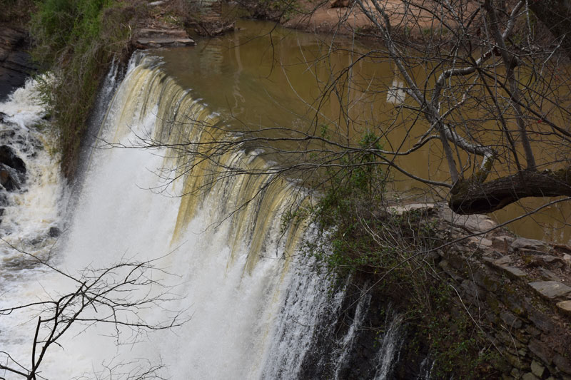
Finally we emerged into a large cavern filled with multicolored lights and music, at the end of which was the main attraction: the waterfall. Each tour group gets seven minutes to look and take pictures.

The experience was okay–the colors were neat–but I would have liked to have been in the chamber alone, in complete silence but for the cascading water. I wonder if such a thing is possible.

My flash photos seemed to be catching a lot of spray, so I took many photos without the flash. I thought about asking someone to take my picture in front of the falls, but before I could muster up the courage, it was time to head back out.

Ruby Falls

Ruby Falls

You head out the way you came in, so other than a few side tunnels, the view was the same. Eventually we were back at the elevators waiting to go up. The tour guide pointed out a different cave that’s used in the fall for a spooky Halloween tour ranked sixth in the nation by the Travel Channel. It’s also the emergency exit if the elevator ever breaks down.

After we emerged from the elevator, I tipped the tour guide (he was sexist, but he was good otherwise) and then headed up to the observation platform. The view was okay, but filled with power lines and industry, so not ideal. Then I went down into the gift shop and purchased the picture of myself that was taken in the cave. I also got a Ruby Falls magnet.

By this point I was starving, so I grabbed a turkey sandwich and a water from the refreshments counter before heading back to my car.

The lady at the counter inside had said to do Incline Railway next, but a guy in the parking lot advised me to do Rock City first. He sounded like he understood my timetable, so I took his advice and drove around Lookout Mountain until I finally found the place. (GPS was telling me to do some weird stuff; I finally just turned it off and followed the many signs.)

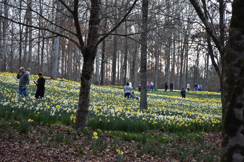
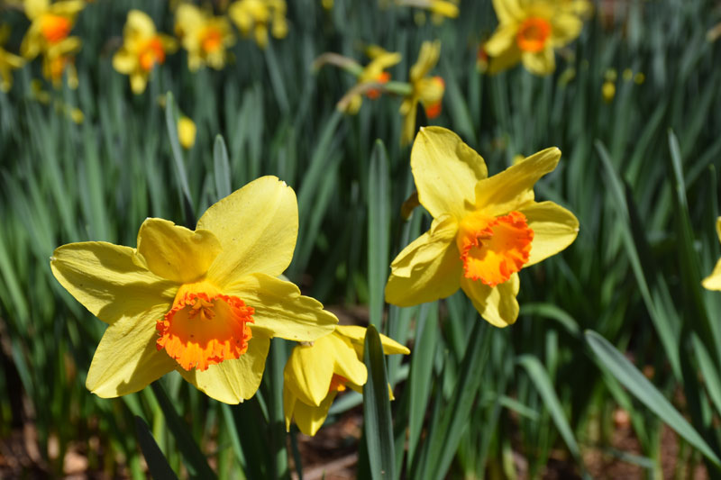
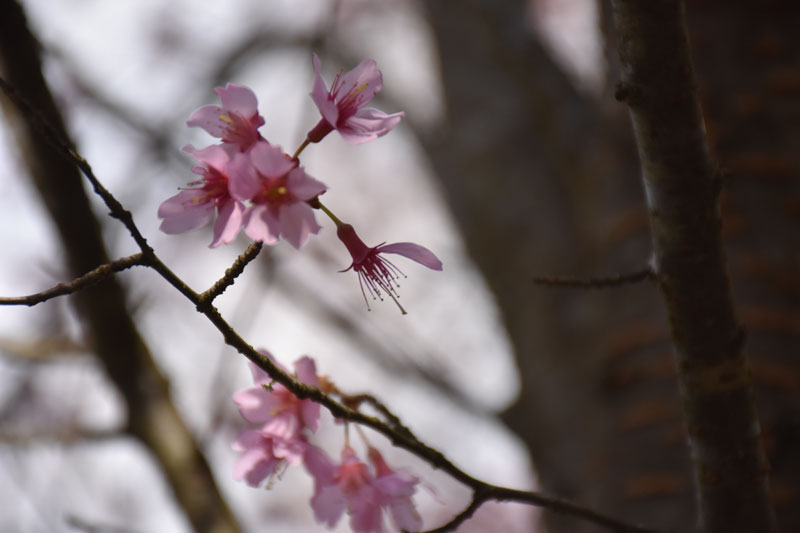
I didn’t have a good idea of what Rock City was before I arrived. I had seen billboards and looked briefly at the website, but my impression had been that it was a nature trail in the mountain that led to a cool lookout point. The second part is correct; there is an awesome view with a waterfall called Lover’s Leap, and that’s what you see in all the pictures. But the way to get there is not a nature trail. Rock City is actually an elaborate, meandering garden of stone and plant life. You walk down a paved stone trail through cliffs and rock formations and view carefully tended shrubs, flowers and trees. There’s music at the entrance to the garden. At first I was a little disappointed; it seemed cheesy. But once I got beyond the music and deeper into the gardens, I started to appreciate the effort that had gone into designing this beautiful area.

Rock City

Rock City

The trails curve around, up, and down, so that you’re often doubling back but you’re higher or lower than you were before. There are stone bridges and an extraordinarily fun bouncy bridge.

Looking down from a trail

Rock City trails

There are also gnome statues in various playful poses throughout Rock City. At one point there’s an entire gorge filled with them.

Of course, the main attraction is Lover’s Leap, which is as beautiful and breathtaking as the pictures. You get good viewing angles of the outcropping from various points in the garden.

Lover's Leap

Past Lover’s Leap is another observation area called Eagle’s Nest, and a small wedding ceremony was taking place there. Everyone was dressed in white and black and at least one of the maids of honor was wearing elf ears, in honor of the fairytale theme of Rock City.

At this point I thought I was pretty much done, but the gardens continued. The trail curved back around through more formations and sights, including a slim passage called “Fat Man Squeeze” and a deer sanctuary. Eventually it came back out to an alternate view of Lover’s Leap with a better angle for photos of the waterfall.

Lover's Leap and waterfall

And there was more to see after that. Winding through the garden trails, eventually you get to a cave with a fairytale-looking entrance. The designers of Rock City were German and were very into folktales. They built this part of the garden to celebrate fairy stories of all kinds. At first you see gnomes and fairies in playful scenes here and there. Then you come to Mother Goose Village, where actual nursery rhymes and fairy tales are reenacted in dioramas. Everything is illuminated with black lights, making the colors on the models shine an unearthly neon.

Goldilocks

One little girl was so excited about each fairytale scene that she kept screaming at her family, “Come on! You have to see this!” It was so cute.

Eventually I emerged back into the sun, very close to the entrance of the park. On my way out, I stopped at the candy shop for some “Elfin fudge”. I knew I’d be out and about and the candy would probably melt, but I bought some anyway: a thick slice of peanut butter fudge, a ball of divinity, and four raspberry truffles. The fudge and the divinity actually held up rather well, but when I finally pulled the truffles out the next day, they had completely melted.

The guy at Ruby Falls had recommended I do the Incline Railway from the base of the mountain. He said this was better for people who were scared of heights, but it also sounded like it would mean saving the more exciting experience for last. So I drove down Lookout Mountain and back into Chattanooga to the lower station. For the first time, I had to pay for parking, but it was only $3, so I didn’t mind so much.

Incline Railway station

The little train station was cute. I checked in with the lady at the window, then walked around the track to the other side, where a photographer took my picture in front of a green screen. (I didn’t opt to buy the result.) Then I joined the line of people waiting for the next train. It didn’t take too long.

Though I was behind quite a few people in line, no one sat at the very end of the train where you could see down and out the best, so I sat there. I wondered if I should have sat at the back and watched the progression upward instead, but ultimately I really enjoyed seeing the train station and then the city slowly recede.

The ride was slow and not scary in the least. At times the train passed over a road or valley, but for the most part it ran right along the ground all the way up Lookout Mountain. I had a hard time capturing the height the train reached and the steepness of the track in photos. I get the impression it looked far more impressive in person than it ever will in a still.

heading up the mountain

further up the mountain

View of an Incline Railway train

The top station has a larger gift shop than the bottom station. It also has two levels of observation platforms from which you can view the city below. I went up and took some pictures, then wandered around for a bit wondering what to do. This was the last thing I’d planned, and it didn’t seem like a very impactful way to end the day.

I went outside and looked around. The top station is smack in the middle of a nice mountaintop neighborhood. What at first appeared to be a beautifully manicured park entrance was actually someone’s front yard. I noticed a sign pointing to “Battles for Chattanooga / Point Park”, so I headed that way. The walk was lovely; lots of nice houses and flowers and grass and trees. There was also a large open area next to the train station with lots of “No Trespassing” signs; whoever owns that land has a lovely view.

Eventually on the left I saw a Civil War museum. Advertisements boasted of a 3D Electronic Battle Map, which sounded really boring to me at the time. In retrospect, it probably would have been neat to see, but I guess I was in an Outside sort of mood. I passed the museum and headed to the end of the street, at which I found Point Park. The site of some hard-fought Civil War battles, the park has a walking trail alongside amazing Chattanooga overlooks. I paid the small entry fee, then wandered in and found plenty of places for photos.

Tennessee River as seen from Point Park

cannon and Tennessee River

As you round the curve to loop back to the entrance, another trail branches off to the Ochs Museum. I headed down to see what that was. It turned out to be another military fort building with an air conditioned room containing Civil War photographs from the area, as well as some memorabilia. The museum is named for the philanthropist who established Point Park. Beyond this room is a broad semicircular area overlooking Moccasin Bend in the Tennessee River.

Moccasin Bend

Point Park has some of the best views I saw in Chattanooga. I’m so glad I wandered down the street instead of just getting right back on the train.

For the return trip down the mountain, I got on first and went straight to the front. I wanted to see if the experience of going down would be more exciting, and if I could get a different sort of picture or video. Ultimately, though, the trip was so leisurely that I got my fill of photos fairly quickly and then took the opportunity to check Facebook.

Incline Railway train

At the bottom I took a quick spin through the gift shop, but nothing really caught my eye, so I headed out to the street to look for dinner.

There are a few restaurants in the area of the lower station. Right across the street is Mr. T’s Pizza and Ice Cream. I actually saw it on my drive in and thought it looked cool. However, I strolled around a few blocks to make sure there wasn’t something else I wanted. The seafood restaurant, 1885 Grill, was extremely busy, with a line out into the street. The burrito place looked a little too much like a bar. Other places were only open for lunch. Finally I decided Mr. T’s would be fine; there was no line, and freshly-made pizza sounded pretty good. I went in and ordered an 8″ Classic, which is your standard tomato sauce and cheese pizza with a bunch of meat. It was delicious. I also got a side salad.

Mr. T's pizza

I thought about having some ice cream for dessert, but I was pretty full after all that pizza (I couldn’t finish it), so I decided it was time to find my bed for the night.

This trip was my first experience using AirBnB. I stayed in the second bedroom of a woman’s apartment. She never came home, so it was like having an apartment all to myself. The place was beautifully decorated and felt very welcoming. I watched a little cable TV, as I enjoy doing whenever I’m away from home, and then turned in for the night. I knew I had to leave the Chattanooga area by 10, so I set my alarm for the latest time I should get up, 9.

I had some trouble getting to sleep, perhaps due to being in a strange bed, perhaps due to excitement, but eventually I managed it. I awoke at 6 feeling pretty refreshed, so I went ahead and got up. Since I had a few hours, I decided to go explore downtown Chattanooga.

I’d found a restaurant on Yelp that sounded decent, so I put its name into Google Maps and headed in that direction. It was near the aquarium. At first I pulled into a paid parking lot, but then I noticed that street parking was free at the time, so I quickly moved the car.

Not feeling particularly hungry yet, I decided to walk around a bit and take pictures. On my way into town I’d driven over an awesome bridge with sidewalks called P.R. Olgiati Bridge, so I headed back that way and strolled across.

Summer by Daud Akhriev

pedestrian bridge

bridge

Delta Queen

I got lots of pictures of the river, the riverfront, and the John Ross pedestrian bridge across the way, which I decided to use to get back. I headed into the north end of town, turned right, and walked down Manufacturer’s Road, snapping pics of storefronts. I noticed a restaurant called Good Dog was open, and then I realized I was hungry, so I stopped in and had their sausage and gravy breakfast sandwich. It was delicious.

breakfast

A group of people in t-shirts were at a table across the room having beer cocktails. It was 8 o’clock in the morning.

Back out on the street, I considered walking down into Renaissance Park; I’d gotten some good overhead views of it from the bridge and it looked interesting. But I was eager to get to the pedestrian bridge, so I passed on the park and kept going.

The pedestrian bridge was everything I’d hoped it’d be, a long boardwalk with an intriguing overhead structure and great views of Chattanooga and the river. I smiled at everyone who was out biking, jogging, and walking dogs. There are so many cyclists in Chattanooga; it’s awesome.

pedestrian bridge

Delta Queen

art museum

Once across the river, I turned left toward the art museum, which sits atop a dramatic bluff along the river. The museum appeared to be closed that early on a Sunday, but I got some exterior shots. I also found a sign with a downtown map that led me further away from where I’d parked, to an overlook area with a sculpture garden. It was lovely.

sculpture

sculpture

dewy buds

After that I meandered back into town. I walked past a children’s science center and the baseball stadium, then found my way back to my car just in time to set out for my next adventure…whitewater rafting on the Ocoee River.

I’d say my first visit to Chattanooga was a resounding success!

Check out all my pictures from this trip here.

A glorious day in Midtown

Midtown skyscrapers

In my post about second homes, I mentioned that I hadn’t quite made that special connection with Atlanta yet. This past Tuesday, I realized that’s not exactly true. I do have strong feelings…for parts of Atlanta.

It only makes sense. Atlanta is huge. The sprawl just keeps going and going. Much of the city is strings and clusters of strip malls, businesses, and homes that are only accessible by car. Of course I wouldn’t find that homey, walkable, or natural.

But there are places where I can stroll around happily for hours and find plenty to do and see. As I rediscovered Tuesday, one of those places is Midtown.

Midtown skyscrapers

My friend and former coworker Stephanie just moved back to the Atlanta area–we met in Augusta, but she grew up here. We’ve been trying to get together and do something for awhile, and finally this week things came together. She and her baby Landon, who is just about to start walking but for this day spent most of the time in his stroller, met up with me at the High Museum of Art.

High Museum of Art with signage for Frida and Diego exhibit

Stephanie hadn’t been there since she was in school; as for me, the last time I’d visited was for the Picasso to Warhol exhibit a year ago. I acquired a photography permit (something I don’t recall them doing last year) and signed a statement agreeing not to post my photos online (alas), then we got to exploring.

We started in the Stent Family Wing, heading up the ramp to see European Art from the 14th to 19th centuries and American Art from the 18th to mid-19th centuries. We took a short break so Stephanie could feed Landon; I was impressed with how organized and thoughtful a mom she is. After a quick diaper change, we were able to take in the first part of the visiting Frida & Diego exhibit before Landon became too fussy to continue. All the while, Stephanie and I chatted about the art, and travel, and cutie Landon, and it was a lot of fun!

I wasn’t quite ready to leave yet, so after walking Stephanie and Landon down to the lobby, I headed back up to finish out Frida & Diego. I hadn’t heard of Frida Kahlo or Diego Rivera before this exhibit came to town, so it was an eye-opening experience. They both had such fascinating lives, their relationship with each other a pivotal point. One of Frida’s paintings in particular, “The Broken Column,” so strongly resonated that I had to fight burning tears. Frida suffered crushing injuries in an accident when she was 18. Her spine was broken in multiple places and her uterus was impaled. These injuries left her in a lifetime of pain and unable to carry a pregnancy to term. She died young, at 47. “The Broken Column” is a self-portrait. Frida gazes at the viewer, standing tall despite the exposed, fractured column that represents her spine, her body riddled with nails, her face streaked with tears.

All of the Frida & Diego exhibit is amazing and informative; I highly recommend checking it out before it leaves Atlanta in May.

After Frida & Diego I went up to the Skyway Level to see Gogo: Nature Transformed, a temporary exhibit of jewelry based on designs found in nature. Much of it was cast from molds of animal bones, and I didn’t really care for it. After that I wandered through the Modern Art exhibits, which were far more to my liking. I especially enjoyed the furniture designs; the High has pieces from Frank Lloyd Wright (instantly recognizable) and pieces that were sold by Herman Miller in the mid to late 20th century. One thing I also appreciated about the Modern Art exhibits, and the others that incorporate furniture or sculpture, is the way the museum has arranged all the pieces. Designing an exhibit is an art unto itself.

After Modern Art I skipped Folk Art and went straight to Contemporary Art. I remembered many of the pieces–Anish Kapoor’s untitled reflective dish, for one–but new items had appeared as well, and other exhibits and pieces that were on display last year are now gone. Then I went down to the Third Level and looked at American furniture, paintings, and sculpture from the 19th and 20th centuries. Items I found especially fascinating were an ornate cabinet, an intricate piano built for its looks rather than its sound, a group of face jugs from Edgefield, South Carolina, and two separate still life paintings featuring dead fish.

Finally I went down to the Lower Level, where I strolled through the Works on Paper exhibit and the African Collection. I found myself drawn to three paintings by Will Henry Stevens in Works on Paper and a display case filled with intricately detailed metal curios in the African Collection. And with that, my wonderful five and a half hours at the High were concluded.

High Museum of Art

At that point I was pretty hungry, so I decided to try and find food. I’d had a protein bar at around noon, but it was now 4:30. At first I thought I’d just go to the restaurant next to the High, but nothing on their menu sounded appealing, so I got on Yelp! to see what was available in the area. Unfortunately, the Midtown branch of South City Kitchen wasn’t open yet. I tried to go to a place called Article 14, but I couldn’t find it. (I ended up passing it later in the evening on a completely different street from where I’d been looking, but in my defense, the streets are both called Peachtree.) Eventually I decided to just keep walking around and eat whenever I found a restaurant that looked good. It took about 45 minutes, but I finally came across a pizza place called Vespucci’s, so I stopped there and had a delicious pepperoni calzone.

Pepperoni calzone from Vespucci's

Thus recharged, I decided there was still enough daylight to warrant going to Piedmont Park, so I headed off down the other Peachtree Street and then up 14th Street, all the while taking photos of beautiful Midtown. I got to the park at around 6:30 and spent about 45 minutes strolling through it, circling the pond and snapping photos of flowering trees and shimmering water. It was pretty out, though it was starting to get cold; I kept my hands in my pockets as much as possible.

Flowering tree at Piedmont Park

Flowering tree at Piedmont Park

Midtown skyline as seen from across the pond at Piedmont Park

Detail of a flower on a tree at Piedmont Park

Pavilion on the pond at Piedmont Park

Visitors Center at Piedmont Park

I took more Midtown shots on my way back to the car. The setting sun made for some nice light.

Reflected skyscraper bathed in a wedge of sunset light

Sunset light washing over 14th Street

I was headed off for home before darkness had a chance to settle in, thanks to Daylight Saving Time. (I may be the only person who likes DST.) As I found my way back to I-75, the dwindling sunset painted Midtown pink.

Pink-hued Midtown skyscrapers

I’d had an awesome day, but somehow I didn’t want to go home yet. I called Sean to see if he wanted to go out to dinner, but he didn’t, so instead of going to the apartment, I drove to our local movie theater to see if they had anything interesting. At the time, my mood was swinging toward either Emperor or A Good Day To Die Hard, but neither was playing at that location. Oz the Great and Powerful was available, but I’d read a review that had somewhat soured me on seeing it…so I went back to my car and pulled up Yelp! again, deciding to just go ahead and have dinner. A search for nearby restaurants revealed a Thai/Malaysian place in an adjacent shopping center. Given my love affair with Penang, that sounded like a plan to me, so I hopped out onto Cobb Parkway and then right off again, heading straight back to Top Spice.

The ambiance wasn’t quite as cozy as Penang’s, at least not in the entryway. I felt rather like I was on stage, as all the tables were raised above the level of the front door and there was no half wall or anything to provide a feeling of privacy. Once I was snug in my booth, though, I was quite comfortable.

Interior of Top Spice

Rather than an entree, I decided to have two appetizers. This was mainly because they had roti canai and I love roti canai, and I knew if I got roti canai and an entree, I wouldn’t be able to finish. The second appetizer I chose was called martabak. It’s made with the same Malaysian “pancake” as roti canai, but it’s a beef and onion curry wrap. Somehow the flavor wasn’t what I was expecting, and I’m not sure I liked it. The roti canai was good, but Penang’s is better.

Then I gave in to temptation and tried their sticky rice mango, and it was amazing. The plate featured three separate items: a sticky rice patty with sesame seeds, a neat pile of mango slices, and a small bowl of coconut syrup. At first I tried alternately dipping the rice, then the mango into the syrup, but I soon found that assembling bites of all three at once created the ultimate flavor. Sticky rice mango is one of the most delicious desserts I’ve ever tasted. I devoured it all.

Sticky rice mango at Top Spice

With that satisfying conclusion to my meal, I was finally ready for my day of adventures to end. I headed home in sublime contentment, my belly full of yummy food, my camera full of photos, and my brain full of happy memories.

View more Midtown photos | View more March 2013 photos

Adventure at Sweetwater Creek State Park

Today I spent five hours exploring Sweetwater Creek State Park, a conservation area to the west of Atlanta. I walked, I hiked, and at times I even climbed, wandering around four marked trails and covering nearly nine miles. I saw beautiful forest, plenty of squirrels and bugs, a couple of deer, two tiny frogs, a long expanse of creek churning through white and gray stone, and the beautiful brick ruins of a mill.

Ruin of new Manchester Manufacturing Company millI got out of bed this morning determined to do something with my day off other than clean, cook, sit at my computer, and watch TV. I’ve gotten into a decent rhythm of late with chores and meals, and this has helped us to save money by not going out to eat, but I’ve been going stir crazy in the apartment. I needed to get out and do something fun and productive and healthy. So I decided to find a park to explore.

Atlanta has no shortage of parks, as I discovered when I started googling. This list is huge, and it isn’t even conclusive. I scanned down the page for anything with a good deal of acreage, then started checking for websites or community information. A number of interesting sites cropped up, including Grant Park, Freedom Park, and Chastain Park. (I’ve been to Piedmont Park before and wanted to find something new.) At some point my searching led me to the PATH website. The PATH Foundation builds walking and cycling trails across Atlanta. I was intrigued by several of the projects, including the Silver Comet Trail. I realized I had already seen part of the South Peachtree Creek Trail when Charles and Heidi took me to Mason Mill Park years back.

Ultimately, though, I decided I wanted to rough it a little more, and Sweetwater Creek, a conservation area, started to stand out. I noticed that it’s relatively close to where we live, and from the description it sounded like it would be really fun to explore:

Sweetwater Creek State Park is a peaceful tract of wilderness only minutes from downtown Atlanta. A wooded trail follows the stream to the ruins of the New Manchester Manufacturing Company, a textile mill burned during the Civil War. Beyond the mill, the trail climbs rocky bluffs to provide views of the beautiful rapids below. Additional trails wind through fields and forest, showcasing ferns, magnolias, wild azaleas and hardwoods.

My destination decided, I set about preparing. Obviously my Nikon was going. I shifted my wallet and little Canon into the bag. I’d also need provisions. I packed a bag of almonds, an Atkins bar, and some snack crackers, then made some tuna fish salad to carry in a cooler with an extra bottle of water. I also fried some bacon, and despite the fact that I left it too long and it got crunchy, I bagged it up as well.

Then I realized that I should probably charge my Nikon’s battery.

As I sat watching the blinking light on the charger, waiting for it to stop its strobing, I realized I would go nuts if I sat around waiting any longer. It was past noon, which meant the Marietta Square Farmers Market was open; I went to an ATM to pull a $20 and then headed up there to buy peaches, tomatoes, and potatoes. (I also bought a small lemon-chess pie for $3 from a vendor whose sweet potato pie is apparently beloved by President Bill Clinton.)

This little excursion gave the battery plenty of time to charge. However, by the time I got home, I was hungry, and Sean needed lunch too. So I boiled some hot dogs and made macaroni and cheese and sat down and ate. Time ticked by as I waited for the food to settle.

And then, finally, I was ready.

Everything was all packed, so I snagged the cold items from the fridge and put them in a cooler with some ice, grabbed the camera bag and my Camelbak water bottle with purse strap addition, and I was on my way.

The drive wasn’t bad and the website’s directions were pretty clear, so I found the park without incident. Upon arriving I discovered there was a $5 parking fee; I hadn’t thought of this, so it was fortunate that I had change from the farmers market. “Enjoy the park!” the man at the booth said cheerfully, and I drove back on the winding road through the trees to the parking lot at the very end, near the Visitors Center.

I’d read up on the trails online before heading out, and I intended to simply take the red trail; it was short and sweet and led to the main attraction, the mill. However, there were people everywhere. A group of kids, one a teen, one possibly a tween, and one who looked maybe 7 were goofing around and talking loudly. Huge families and throngs of friends loped by with baby carriers and walking sticks. I felt that to avoid them–to keep them out of my personal space and my photos–I would have to keep hurrying up and then stopping and waiting, and that didn’t seem enjoyable. So when an unmarked side trail branched away from the red trail, running down along the creek, I took it, and was instantly comforted by solitude.

Side trail along Sweetwater CreekEventually the side trail I was on led me to a bridge that spanned the creek; I saw that the yellow trail also led here. I remembered vaguely from my reading that this trail was longer than the red trail. More importantly to me, it was deserted. Everyone seemed to be fixated on the red trail. Without a second thought I crossed the bridge.

Yellow trail bridge across Sweetwater CreekI got turned around at first, heading down what I thought was a trail but what was actually apparently a service road. RunKeeper’s GPS helped me see that I was going nowhere; I turned back and found the yellow markers leading off away from the bridge, along the creek the way I’d come on the other side. I followed them, and eventually a left fork in the trail guided me away from the creek and into the forest.

I hiked uphill. It was a long climb, but I felt good. It was only when I’d reached what seemed to be the highest point of the trail (though it was hard to tell with all the trees) that I saw any other people. Two men walked by together, and then a third came up behind them moments later. I greeted them all cheerfully.

Yellow trail, Sweetwater Creek State ParkAs I wound my way back down and around, I remembered that the yellow trail was a loop, and the fork in the trail must have defined its start. Sure enough, I found myself walking back along the banks of the creek, and eventually I passed the point where I had set off into the woods. I retraced my steps to the bridge, crossed back over, and this time followed the yellow trail back to the parking area.

I could have called it quits then and headed to the car. It had been a good hike, with lots of uphill climbs. But I had plenty of water left, and I wanted to see the mill. So I turned back to the red trail, which by this time was thankfully less populated. One of the first things I saw was a beautiful butterfly atop a mound of dog doo. Of course I got a picture.

A gorgeous butterfly atop a turd.I found the beginning of the red trail to be far less strenuous than the yellow trail had been. It was mostly flat and very wide. Occasionally there would be an area off to the left where I could climb down to the rocky shore. The red trail also offered some lovely views of Sweetwater Creek.

View from the boardwalk alongside the ruined millIt wasn’t long before I reached the ruined mill. I was overjoyed to discover plenty of great angles for photography, from the trail and from down along the creek. The mill is inaccessible thanks to chain link fencing, but the views are still spectacular. The crumbled brick and empty windows reminded me of the old Sheldon Church ruins near Beaufort, the ruined abbey in Whitby, and Roche Abbey. And the wooden steps down to the mill reminded me of the forest jaunts my classmates and I took during our 2001 trip to Japan. Meanwhile, the water lapping and sometimes surging through the smooth rocks of the creek took me back to my childhood exploring of creeks and rivers in Kentucky. I was enchanted.

Mill stairs creek and rocks
Ruin of new Manchester Manufacturing Company mill Ruin of new Manchester Manufacturing Company mill

Once I’d had my fill of the mill, I decided to keep going on the red trail; a sign indicated that “Sweetwater Falls Overlook” lay ahead just half a mile. I didn’t remember from my morning reading that this part of the red trail was difficult, and so I was surprised when soon I was having to climb over rocks and fallen trees and watch my footing across narrow passages. It took much longer to navigate this part of the trail.

Small, rusty slide, red trailEventually I came across a large family I’d seen earlier; they were out on the rocks looking at and playing in the water. “She caught up with us!” yelled the father, as though this was a horrible thing to have happen. “Everybody back on the trail!”

“What, are we racing?” I mumbled to myself, annoyed, and continued on. I found a set of metal stairs, easily traversed, and shortly thereafter a long passage of railroad ties that might have been meant as stairs but which were far too steep to walk up. I used my hands and climbed, eventually finding myself on a boardwalk. I could still hear the loud family below me, but they seemed to be growing distant. I wondered if they would attempt the climb; it seemed a bit much for the littler ones.

Looking down from the boardwalk, I saw the creek cascading a few feet down some rocks, and I took a picture.

Sweetwater Falls?It never crossed my mind that this could be “Sweetwater Falls”. When I hear “falls”, I expect a waterfall–something tall. So I kept walking, wondering when exactly I would find the falls.

I knew that the red trail had ended and that I was now on the white trail; when I’d climbed up the hillside, I’d been met by a sign indicating that the blue trail was to the right and the white trail was to the left. I’d gone left, thinking the right would just go back to the parking lot (which, as I discovered much later, was correct). I didn’t remember that the falls were supposed to be at the end of the red trail. So I kept walking and walking and walking. And of course, I never found any “falls”, though I did enjoy the views of the creek to my left and the rocky cliff face to my right.rocky cliff faceflowersEventually the trail headed away from the creek and into the woods, and I knew I’d missed the falls somehow. “If I hadn’t seen the mill, I’d be pretty disappointed right now!” I said aloud. I decided to see where the trail went rather than turning around. I didn’t remember anything about the white trail; I was assuming it was one-way and that I would eventually have to go back, and I decided that when I did, I would take the blue trail to avoid having to climb down the side of the hill.

But the white trail kept going, eventually coming to a bridge and some very helpful signage. The bridge, apparently, led to a residential area; I was at the very edge of the park. The white trail continued in a loop that would eventually end back up near where I parked. It was quite a distance, but so was the way I’d come…not to mention that the way I’d come was rough, while the white trail seemed smoother. I continued forward.

White trailAfter a time, the white trail stopped being as obvious. Occasionally the forest cover would break and I’d emerge into a meadow; sometimes white strips were affixed to various plants along the way, and sometimes there was no sign of which way to go. I find it easy to follow established forest trails, whether marked or not, but I wanted to make sure I was headed in the right direction. Sometimes different trails would intersect with the one I was walking, and I was never quite sure if I should take them. I consulted RunKeeper’s continually-updating map to help me decide; somehow the GPS kept working even when I was out of my service area.

Moon visible from clearingFor the most part I made the correct decisions, but at one point I was flustered by the fact that the sun was going down and I needed to get north as soon as possible, so I followed an unmarked trail that seemed to be going in the right direction. At first everything seemed fine; it was a wide, clear path. My first indication that something was amiss was when I came upon a house. I was still within the boundary of the park, so I assume it was the home of a caretaker; there were two trucks in the yard, and one of them was marked “Georgia Department of Natural Resources”. I probably should have just turned around then, headed back to where the trail split and taken a different branch…but instead I kept going.

The path turned into what was obviously a service road, and that turned into a wild mess of rutted dirt and fallen trees. As I tramped through, a deer looked up, startled, and before I could raise my camera, it bounded away. Another one disappeared into a stand of trees just beyond it. I was a little unsettled, but continued walking; GPS informed me that I was at least heading in the right direction, so I hoped I would come upon one of the marked trails shortly.

deer footprintAfter awhile, the service road seemed to die out, and I was again walking a forest trail. This trail, though, was unmarked, and often unclear; it may not have been a human trail at all. I was having no trouble following it, though, and it was still going in the right direction, and the day was growing ever darker. I couldn’t see turning around at this point, not if I wanted to get to my car before the sun was completely gone.

For the last stretch of woods, there was hardly a trail at all. At one point, a thorny branch seemed to wrap around me, hooking itself to my clothes, and I had to wrestle myself free. The leaves crunching under my feet made me paranoid about snakes; I watched every step like a hawk.

And then, finally, blissfully, I spotted a clear trail running directly perpendicular to my current vector. I plunged out of the wilds and back into human space.

It was the blue trail. I turned left, and it guided me back towards the park entrance.

The trail was simple and mostly flat. I walked briskly, not daring to run in the dying light but knowing I needed to get out of the woods fast. At one point I stopped for a photo; the flash went off and two deer I hadn’t even noticed bounded away, perhaps the same pair I’d seen earlier.

As the trail wound around, I groused at it inwardly for not leading straight back to the parking lot. But finally the trees opened onto the back of a building I recognized as the Visitors Center, and the trail guided me up past it to a gently curving sidewalk. At the very end of that sidewalk was the parking lot, and directly across from it sat my car…the only vehicle left in the lot.

my lone carI had made it!

I slid into my Yaris and turned up the A/C. Taking deep drags from the spare water I’d left in the cooler, I drove my winding way out of the park and back to I-20.

In all, the hike lasted five hours. Here’s the RunKeeper map. Towards the end I could tell my legs were tired, but at the same time I felt like if I’d only had more water and sunlight, I could have kept going forever. When I got home and started cleaning up, I discovered thick rings of dirt around both ankles, evidence of my day of hard fun. I also discovered I’d taken a whopping 408 photos, which I later culled down to 377. Click here see them all.

This amazing adventure was just what I needed. It left me so energized and happy. I’ll definitely have to remember to go hiking the next time despondency tries to set in!

me

Too many photos

The biggest drawback of how many photos I take is how easy it is to amass a ginormous backlog. Right now I’m sitting on nearly three months of pics, including two trips home to Kentucky, my two weeks in Augusta finishing out my old job, and my recent trip to New York state…not to mention various local shops and eateries and adventures.

I’ve been taking pictures with my PowerShot these days rather than busting out the Nikon, because I don’t normally need to edit the PowerShot snaps before uploading, and that saves a lot of time. But I still need to go through, delete the pictures that didn’t turn out right, and batch rename them all (I prefer a date-based filename rather than IMG_0001.jpg). Then there’s creating galleries on SmugMug and uploading. And let’s not even get into tagging and captioning; I haven’t been doing that for months. Maybe years.

It’s kind of disheartening to think about all the photos I have left to upload, and all the uploaded photos that aren’t properly captioned and tagged. Sometimes when I take a photo I think of the caption right then, and I wish there was some way I could append it to the EXIF immediately. Maybe someday there will be a camera that has that sort of feature, via voice recognition or a slide-out keypad. Maybe one exists now, but if so, I don’t own it.

In any case, part of the reason I’ve been so lax on uploading photos is simply that I’ve been busy working and traveling. I’m finally to a point where I have plenty of free time, and I’m trying not to just fill it with watching Netflix, but it’s harder when I don’t have a set daily structure. I also have other goals, including finally getting my wall art hung up around the apartment and unpacking my various dishes and curios and finding places for them.

The pictures will get done, and hopefully soon…but I’m not sure exactly when.

A little extra work

Two weekends ago I went on one of my photo adventures, hitting various scenic spots around the area and taking pictures. I spent a whole Saturday exploring and snapping, and then on Sunday I began processing the photos.

This time, rather than simply saving off the camera and uploading immediately, I tried editing each photo using some tricks I read about online. I was extremely pleased with the results; I feel like I’ve taken my first step out of casual pointing and shooting and into real photography.

First I evaluated each photo, rotating and cropping where necessary. Then I applied Image > Adjustments > Match Color > Neutralize, which I read about here on Sitepoint.com. I had used the other option mentioned in that article, Auto Color, before, but wasn’t always happy with the results. Match Color > Neutralize really helped make the color of my photos look natural. I was especially happy with the Color Intensity slider, which helped me bring out color without affecting detail.

For most of the daylight photos, Match Color > Neutralize was very beneficial, but it wasn’t necessary on all of them.

After rotating, cropping, and normalizing the colors, I went through a variety of adjustments. My friend Don posted a link on Facebook to this technique used by a photographer to enhance colors on his images. I ended up modifying the technique a bit, depending on the photo I was editing.

To begin with, I didn’t use the High Pass filter at all. Most of my photos were shot in bright daylight, and all that filter did was cause weird halos that didn’t add anything to the scene. However, I made heavy use of Blend Mode. I would duplicate the background layer, then change its blend mode from Normal to Soft Light (or, in a very few cases, Hard Light). Sometimes I’d Desaturate the top layer; other times I’d leave it the way it was.

I also fiddled with the opacity on the top layer to get the exact contrast and color pop I wanted, and on some photos I played with Curves and Levels to get richer contrast effects.

By the time I got to the last location, Thurmond Dam, the sun was setting. I had never managed to get a really good nighttime shot before, and I’m open to suggestions about shooting at night. For the shots of the dam from the Georgia side of the river, I propped my Nikon D60 against the side of a tree.

The editing methods listed above didn’t work quite as well for the low light shots. High contrast tended to destroy the details and it was hard to pull out color without making the photo look grainy. I’ll be interested to research and try out different techniques for night photography.

Any thoughts on the techniques I used for these photos? Do you know any shooting or editing tricks?

Photos

So the other day I went to the family farm with Dad, Grandma, and Uncle Steve, and…I took pictures!

This is my grandmother’s high school diploma. Is that awesome or what?

And check out this panorama I pieced together in Photoshop. It ain’t great, but it’s interesting!

Our wedding photos

Sean and me, just married, at Augusta Golf and Gardens

Thankfully, we didn’t lose our wedding pictures in the fire. They were all digital, and Mom had full-size copies. She gave them to me when I visited last, and today I uploaded the full images to my smugmug. Those of you who saw my wedding pictures over on the old Aubrey Family website will find new pictures in the Reception gallery: I’ve uploaded the pictures from the disposable cameras as well as the digital images. Most of them didn’t come out very well, unfortunately, but I do like this one:

Connor taking a picture of me taking a picture with a disposable camera

If you don’t want to wade through all those shots, and instead are interested only in the pictures that I think are good, click here. (Bear in mind that I love them all, but from an artistic point of view only the ones I’ve tagged as “good” make the grade.) If you’d like to nominate a photo to be tagged as “good”, just comment on this post! (I plan eventually to go through all my photos and tag the best ones.)

I’ve also added a “funny” tag to some of these pics. Check it out ;)

Ben with his eyes crossed, holding a sign that says 'Mom says I can't eat between meals, so please don't feed me'.

My baby brother, ladies and gentlemen.

Summerville Tour of Homes

As planned, Brooke and I met up today to attend the Summerville 28th Annual Tour of Homes. I’m sure you could predict the fact that there are pictures. Unfortunately, we weren’t allowed to take any pictures inside the houses, which means you don’t get to see the stuff we were drooling over all day.

After eating far too much at Theresa’s Mexican Restaurant downtown (roughly across the street from Outspokin’), we headed down to the ASU campus, where the tour was to begin. After getting our bearings, we walked to the first historic site, ASU’s Bellevue Hall.

Bellevue Hall

The building has been completely restored and now houses offices for University staff. It looked like a very pleasant place to work :)

We wandered back towards the main entrance where the tour buses would take us to the next site. On our way we stopped and looked at a strange vine maze that I think Connor would love.

vine maze - I wanted to go in!

Then we hopped on the bus and were off to the first house.

Actually, the bus took us to the last house on the tour first. They’d changed the order of the tour, I’m guessing due to traffic considerations. And so the first house we saw was 2532 Henry Street.

I was pleasantly reminded of the older houses in downtown Lexington, like the one owned by my former linguistics professor, Dr. Bosch, or the one owned by my cousin’s son’s dead father’s mother and her lesbian life partner. (Okay, that was difficult to describe…) I thought it was perfectly charming. Brooke’s reaction was something like: “It’s small! It’s so small! I mean, it’s really small!”

We waited for the bus for quite some time, then got tired of waiting and walked back to ASU. We’d planned to take Brooke’s car to the next house, but the funny tour guide lady and driver guy talked us into trying the bus again, so we did.

The next house was 705 Gary Street. Gary Street is probably a block and a half long, and runs between Battle Row and Gardner, near Milledge. The house was built sideways on the lot, allowing the front porch a beautiful view of a line of tall pine trees. As the bus tour guide said, from the front of the house it looks like they’re out in the middle of the woods. This house retained quite a few of its original features, including dark wooden doors with glass knobs and yellow hardwood floors. It had a fantastic wraparound porch that overlooked the backyard.

705 Gary Street

After touring the house, we sat around outside waiting for the bus for a long time. We were far enough from everything that we couldn’t really walk to the next one. Well, maybe we could have, but we didn’t. Both of us were a little disgruntled when the bus finally arrived.

This bus, not the one we’d ridden before but the only other one being used for the tour, took us to 1338 Wingfield Street, of which I did not get a picture. Just so you know, it’s a “classic Augusta bungalow”, made of “stucco, brick, and wood trim”, according to the guidebook. I wish I could actually remember something about the inside of the house. I think this was the one with the cute baby’s room done up in green, but I’m not sure. [Edit: I was wrong! See the comments.] Fun fact: the woman who lives here is named “Cheri”. (Cheri-sama!)

The next two houses were within very easy walking distance, so we strolled over. First was 1447 Winter Street, and next was its “sister”, 1453 Winter Street, right next door. “Their architecture is a Southern version of the American foursquare house in the Prairie style, a predecessor of Frank Lloyd Wright’s revolutionary residential style of the early 1900’s,” says the guidebook. Both of these houses were updated beautifully and were quite luxurious. 1447 had perhaps the largest master bathroom in the free world, and 1453 had a fantastic kitchen.

Next up: 1434 Heath Street. Fun fact! Brooke lives on Heath Street, but by virtue of being on the other side of Wrightsboro Road, does not live in Summerville. This means she pays lower taxes!

1434 Heath Street

Brooke was perplexed by the peak in the porch gable. The guidebook says this style emulates “Oriental” temple roofs and was popular on the west coast. I’m not sure how it got out here.

The final house, 2341 McDowell Street, was Brooke’s favorite. It’s a modified Tudor design with lots of rooms and a two-car garage in the back. Most striking was an upstairs bedroom, quite narrow but with walls almost entirely made of windows looking out on the trees. It was so cozy and open to nature that Brooke and I both decided we’d be perfectly happy living there.

2341 McDowell Street

And there you have it. I hope I got all those details right; trying to remember everything without having photographic evidence is kind of a pain. Brooke, feel free to correct me.

I had a really good time at the Summerville Tour of Homes. I would definitely like to go again next year…assuming I can once again score free tickets ;>

Savannah once again

As you may have surmised from the comments two posts ago, I took David to Savannah on Wednesday–almost exactly a year after my trip with Dawn and Sam. I have now been to that city three times, each time within the span of a day. Someday I’d like to go back and spend more time, with at least one night’s stay in a bed and breakfast or luxury hotel, and just explore and enjoy the sights and shopping and other experiences in relaxation instead of a hurry.

As always, there are pictures.

ah, Spanish moss

I’m getting the impression that Savannah is a “girly town”, because David really got bored on River Street. (Sam? Care to venture an opinion?)

tugboat?

Regardless, we both enjoyed visiting my favorite candy shop and sampling the praline candy. Mmm-mmm-mmm. I remembered how last year we bought a huge box of the stuff and had it all gone by the next day…but this time money was a little tight, so I didn’t buy anything.

River Streetdown a River Street back alley

After spending far less time than I’d expected in historic downtown Savannah, and then walking the length of River Street, David was ready to head out to try and find a beach. We drove off in the wrong direction, then turned around and miraculously found our way to the beautiful Tybee Island. After a brief stop to admire a lighthouse, we picked our way down onto the beach.

seagulls and waves

I was wearing shorts, and I’d already taken my sneakers and socks off to walk in the sand barefoot, so it wasn’t much of a stretch for me to run gleefully out into the water. My pants got thoroughly soaked. The water was warm and foamy and beautiful. You can’t help but feel as if you’re part of something when you’re standing there, rushing tide pounding your legs and sucking the sand out from under your feet, bright sun shining overhead and sky clear and stretching out forever. I wanted to swim…but unfortunately I’d worn a rather nice shirt that I didn’t want to ruin, so I had to content myself with wading.

Between jaunts, I convinced David to throw off his shoes, roll up his jeans, and do some splashing around of his own.

He too got soaked, and his jeans took quite a bit longer than my khaki shorts to dry.

I am so glad that we went to the ocean. If I ever plan my days-long excursion to Savannah, I will seriously consider staying on Tybee Island.

Cumberland Falls

On my way here, I stopped for gas for the last time and noticed that I was at the exit for Cumberland Falls. Why not? I thought. I followed the signs away from I-75, and drove for a long time on twisting mountain roads. Eventually I came to a beautiful stone overlook, so I stopped to get some pictures.

After that, I went on. By the time I finally got to the falls, I was twelve miles away from I-75. I drove past various entrances to restaurants and waterfront homes until finally I came to the park.

First I wandered around the area above the falls, looking at the rocky bed, the surrounding forest, and the beautiful bridge over the water.

Soon I reached a sign that said “DO NOT GO BEYOND THIS POINT”, so I headed off to the right and passed through between the gift shop and the snack bar to the main park area.

And finally, there was the first falls viewing site:

I moved along from there and found several other great angles.

Someday I’ll be as famous as James Archambault ;>

After a little more exploring, I was hot and tired and ready to drive the last 100 miles. I bought myself a souvenir, one of those neat paper storage boxes. My cousin Gabrielle gave me two hat boxes when I was in the hospital (which, of course, were destroyed in the fire); this box is made of the same kind of stuff, except it’s a cube. It’s beige with blue flowers. I also bought some homemade fudge. Then I headed home, fully satisfied with my little detour.

Monday

I didn’t do much for most of Monday. After I got up I sat around and watched TV for awhile, eventually deciding to watch Harry Potter and the Chamber of Secrets. I also ate a lot: cereal, more cereal, Pop Tarts, and a bagel with cream cheese. I was in a bad mood when Sean got home around 3:30, so once Chamber of Secrets was over I left the house to go to the Japanese grocery store.

Which ended up being closed.

So I tried to find a new way home, and ended up on Gordon Highway heading downtown. So I went to the Greeneway and took some pictures.

They put a new fence up around the trail closest to the golf course and the Hammond’s Ferry entrance. Also, it is really starting to look like fall, despite the flowers.

It’s a lot longer when you don’t have a bike and have to walk. It was also pretty hot. I didn’t make it very far before I turned around and left.

After that I went to Outspokin’ to look for a new bike, but they were closed too. (Judging from the parking, everyone was out on a ride.)

Finally I headed back towards Martinez. I stopped at Payless to look for some nice boots, but they didn’t have anything I liked. So I ended up returning home empty-handed, save for the pictures.

I guess I was pouting too much, because Cheryl gave me a lecture about depression, and wouldn’t leave me alone about it. She did say that I needed to go see my mom, but I already knew that.

I was more than happy to get up early on Tuesday, pack, and run away to Kentucky.

Lunch at the beach

If I leave work to the right, pass the way home, and drive for awhile, I end up reaching a bridge over part of the sprawling J. Strom Thurmond/Clarks Hill Lake. There’s a boat ramp just past the bridge to the right. I’ve stopped for lunch there before.

Today I decided to go there because I didn’t feel like driving all the way down to the longer bridge, the one that has two roads leading down to the water. I just wanted to eat and relax–but I didn’t want to go to the Historical Park, because I just went there yesterday.

I was expecting to just park in the shade and stand around staring down the boat ramp at the lake. But when I pulled in this time I noticed that there was a little road leading away from the ramp. Being a curious little bugger, I drove up to it. There was a sign there reading: “Park open April 1 to November 1”.

Public property! I drove down the skinny winding road…and discovered a beach.

shot while standing in water

It was so gorgeous that after I ate lunch at one of the many picnic tables scattered around the woods, I had to take my shoes and socks off and splash in the water.

I'm pretty pale, aren't I?

It was just so nice. I had a lovely lunch.

maple leaf floating in the waterme acting cutesy

Now I’m trying to figure out the logistics of going for a swim over my lunch break. I’ll need a swimsuit, a towel, and probably a shower cap to keep my hair dry…